the footprint has been re-used in the reconstruction.
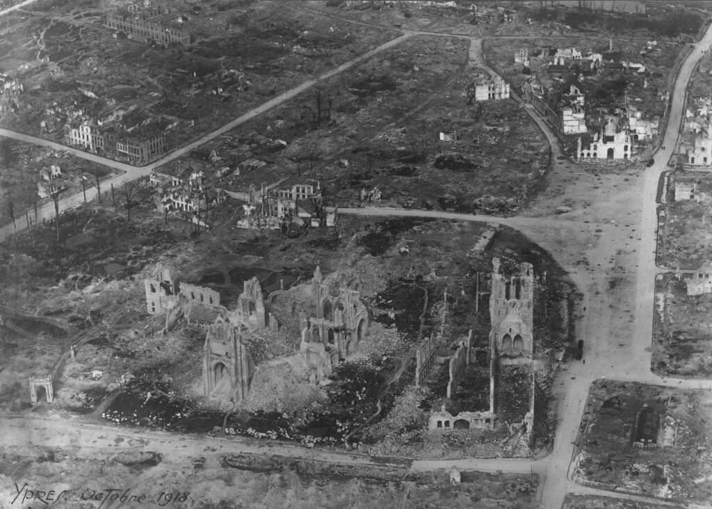
Source: In Flanders Fields Museum, Ypres
In urban reconstruction planning after a disaster, the pressure on the recovery of space, discourse, and organisations brings forward a monomaniac strategy often based on the four-staged recovery model (emergency – restoration – reconstruction – commemoration). Destroyed cities are confronted with a new function: they become a memory landscape, translated into existing heritage such as memorials, monuments, and cemeteries. In this way, memory takes on a double meaning: the city is rebuilt from memories but also serves to remember. However, the space for memory risks supplanting the memories of places based on the real-life experiences of the residents. It is precisely in such (historically significant) urban areas that reconstruction projects often run the risk of further disrupting the contorted daily lives.
This project identifies the relationship between places and memories within the reconstruction of the everyday urban environment after a disaster through the pilot study of Ypres, a city in the Westhoek region, in the province of West Flanders (Belgium). This city is both unique and exemplary since the city was destroyed during the First World War and has been rebuilt according to its pre-war configuration, and since the war memory is tangibly present until today and is now part of the identity of the city. The question arises if (1) the choices made for this reconstruction contributed to the recovery of the residents, (2) and if this urban reconstruction holds back the city in its further development.
Urban reconstruction planning and building have been the subject of ample academic research. However, the great deal of research that has been done results in accepted narratives that are fossilized in urban planning theory. Both the position of everyday heritage within the spatial memory of (former) residents and the degree in which this is considered within urban reconstruction planning stays unclear. This project wants to investigate if considering this could positively impact the process of recovery within the urban reconstruction planning after a war and more widely after other disasters with great spatial impact such as earthquakes, floods, etc.
First, a spatial questioning of the accepted narratives analyses the effect of the reconstruction on the recovery of the residents of Ypres up to the present day. Second, this project aims to understand the spatial configuration of the interaction between place and memory and what position this occupies within reconstruction processes to create support for contemporary reconstruction strategies.
Funded by: KU Leuven
PhD student working on the project: Marie Nevejan
Supervisor: Prof. dr. Gisèle Gantois (KU Leuven)
Co-supervisor: Prof. dr. Rajesh Heynickx (KU Leuven)